 |
 |

Topography
Many, if not most, types of mapped information can be clearly shown in two
dimensions: Political boundaries, population density, or annual rainfall
work just fine as flat areas of color. But a map that shows hills and
valleys can be extraordinarily useful to a cyclist in San Francisco or a
hiker in the Hindu Kush (though not, perhaps, to a skater in northern
Indiana).
Topographic maps address the problem of displaying three dimensions in
two. (The word derives from the Greek “topos,” “place,” and “graphein,”
“to draw.”) A topographical map shows the physical contours of a
landscape, including mountains, cliffs, gulleys, and plains, along with
features such as buildings, roads, ponds, and other landmarks.
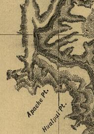
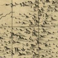
Early mapmakers depicted hills and valleys with shading or hatching, or
drew mountains as little saw-toothed profiles. Such attempts at
topographical information were of necessity crude, in part because there
was no standard to represent the data but also because the exact shape of
the features had not been measured. By the mid-19th century, improved
surveying provided more accurate information about the landscape;
contour lines became the convention for writing this information.
A contour line is simply a line drawn through a series of points that have
the same elevation. By drawing contour lines at regular intervals, such
as every 5 meters above sea level, a mapmaker can offer a reasonably good
representation of the lay of the land. On a topographical map a hill looks
like a bulls-eye of concentric circles, indicating a gentle slope, while a
cliff’s closely massed parallel lines show a steep one. Using the clues
provided by contour lines, a keen map reader can visualize the terrain and
pick out a level route or avoid dangerous drop-offs.
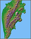
Another form of topographical map breaks the two-dimensional barrier and
extends into the third dimension. Such maps show the land's physical
shape in relief, with bumps for mountains and flat areas for seas. Though
more easily understood than two-dimensional maps, relief maps must be made
of rigid and unwieldy materials, which limits their portability. Still, a
relief map of, say, South America dramatically shows the relationship
between the Andes and the Amazon basin.
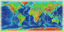
In such three-dimensional maps the vertical axis -- the height of the
features -- must be greatly exaggerated to show any relief. Though
mountains seem rugged to humans, they don't matter much on a global scale:
Mount Everest, the tallest peak, raises a bump smaller than one-seventh of
one percent of the earth’s radius. In other words, if you could hold the world in the palm of your hand, it would feel smoother than a billiard
ball.
Copyright © 1999, 2000 media.org.
|
 |


