 |
|
|||||||||||||||||||||||||||||||
|
As most of the population of Earth has realized from observing astronauts, the safest, easiest, and most comfortable way to explore the unknown is to have someone else do it for you. Adopting that strategy earned Prince Henry "The Navigator" of Portugal not only fame but a long life as well; sea voyages in the 15th century were nothing like today's relaxing cruises. As armchair travelers go, Henry was surely one of history's most successful. He probably never sailed out of sight of land and certainly never ventured farther from Portugal than the closest shores of North Africa. Yet Henry wondered what lay beyond the known world of his age, and had the money and talent to send people into unknown danger on his behalf. Henry was born in 1394, the third surviving son of King John of Portugal and a member of a large and diverse family of European royals. In those days strong monarchs cemented their alliances by marrying their daughters off to the rulers of strategically important nations, with the result that after a few centuries everyone at the highest level of society was related to everyone else. Henry's mother was Philippa of Lancaster, daughter of John of Gaunt; Henry was cousin to three English kings, all also named Henry (IV, V, and VI), and his aunt was married to the king of Castile. Henry himself became a member of a religious order and never married.
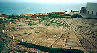
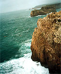
In Henry's time, Portugal developed into a major sea power mainly because it had to. The country lies along the Atlantic coast of the Iberian Peninsula, literally at the farthest southwestern end of Europe. Overland contact with neighboring countries could only be achieved by travel through the hostile kingdoms of Aragon and Castile, with the Pyrenees mountains as an added barrier at the border with France. Sea travel meant braving the rough and difficult Atlantic rather than the placid Mediterranean. As Lloyd A. Brown explained in The Story of Maps, "The Portuguese had fallen heir to the best and worst qualities of mankind; the most highly developed culture was combined with the most primitive barbarity. The result was a people of unusual courage, ingenuity, and greed." In Henry's case those qualities were blended with religion as well. As a faithful Catholic he was alarmed about the rise of Islam, and as Grand Master of the Order of Christ, a military religious order that replaced the Knights Templar, Henry had the financial wherewithal to support expeditions to locate (and exploit) unconverted lands. Henry desired "to make increase in the faith of our lord Jesus Christ and bring to him all the souls that should be saved." He also sought the court of Prester John, the mythical Christian king said to live in Asia. Other goals involved opening trade routes to the Indies that bypassed Islamic nations, and of course, making money. The income from the Order of Christ was enough to bankroll the expeditions, and the expeditions themselves often proved profitable. Nonetheless, such was the extent and expense of the operation that Henry died in debt. Henry's first expedition rediscovered Porto Santo, Madeira, in 1418. He then turned his attention south to find a way around Africa and to explore its unknown coast. In 1434 an expedition rounded Cape Bojador, with Cape Blanco passed in 1443 and Cape Verde in 1446. Portugal claimed the Cape Verde islands in 1456. Henry's mariners followed the coast closely, making drawings and maps as they went; all told 14 expeditions made the trip down the coast. In sending his ships so far south Henry fought an ingrained popular belief that no one could survive the journey. Just as lands to the extreme north are uninhabitable because of extreme cold, so lands to the far south were thought to be uninhabitable because of heat. Traveling south, eventually the sea would boil and everyone would die. But to their surprise, Portuguese captains found humans aplenty in the tropicsand immediately began returning home with cargoes of gold and slaves. Henry forbade the kidnapping of Africans for the slave trade in 1455 but the practice did not stop. After the discovery of the new world, settlements there demanded increasing numbers of slaves and Portuguese slave traders continued their business for three more centuries. Though Henry's influence on navigation was considerable, it was not formally organized. He never established any institutions for the teaching of navigation, but he supported cartographers who recorded and compiled all the information brought back by mariners. His home became a magnet for instrument makers, mapmakers, and craftsmen who learned from and improved upon one another's work. Portuguese sea captains were in demand in other nations, because of their superior skill and equipmentthe fruit of Henry's efforts. Portugal's maritime strength continued long after Henry's death in 1460. In 1488 Bartholomeu Dias rounded the Cape of Good Hope; in 1497 and 1498 Vasco Da Gama found a route to the Indies. (These were the real Indies, not the easily conquered and ultimately more profitable West Indies found by Columbus.) Portugal and Spain, rivals on the Iberian Peninsula, became rivals at sea as well. The 1494 treaty of Tordesillas drew a line 360 leagues west of the Azores, dividing the world into two halves. Spain got everything west of the line (including most of South America), while Portugal got everything east of it, including India and, though nobody knew it was there at the time, Brazil. Henry the Navigator's captains explored the Atlantic islands and the coast of Africa to an extent never before attempted; by sending out ships and soldiers he made Portugal into a world power with colonies in Africa, India, and South America. Brazilians today speak Portuguese in large part because of Henry's efforts. Had he turned his ships westward instead of sending them south, so might we. Copyright © 1999, 2000 media.org. |
|||||||||||||||||||||||||||||||


|